

The image above is from a U.S. Coast Survey in 1859.
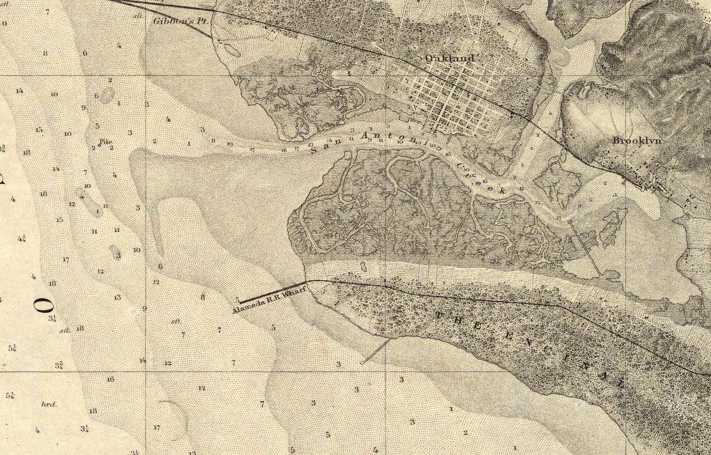
A close up view from the same map. This is the West End of Alameda, and shows San Antonio Creek, Oakland and “Brooklyn” (part of Oakland today), and the area that will become Lake Merritt. Also of note, “The Encinal” in Alameda and the Alameda R.R. (railroad) Wharf.

Here is another close up view from the same map. This is the East End of Alameda and shows the area near High Street as being the most settled. Also seen is San Leandro Bay.

The image to the left is the full map that the close-ups above came from.
| Author: | U.S. Coast Survey |
| Date: | 1859 |
| Short Title: | Entrance to San Francisco Bay California |
| Publisher: | Washington: U.S. Coast Survey |
| Type: | Chart Map |
| Scale | 1:50,000 |
This images of this map are from the David Rumsey Historical collection and are provided here for educational use only.