
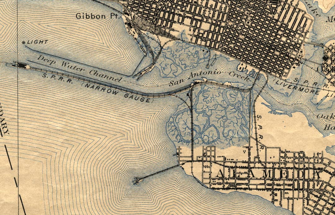
The image at the left is a close up view of the West end of Alameda, from a portion of a map made in 1895. It shows a lot of great detail, including the early railroad and pier (the moles) connections. Good early view of the relationship between the San Antonio Creek, Oakland Harbor, and Lake Merritt. Also note the very large marshy area between Oakland and Alameda, near what is today, the Webster Street and Posey Tube and the areas West of there.
Map info:
Scale: 1:62,500
Willard D. Johnson, Topographer in charge.
Triangulation by U.S. Coast and Geodetic Survey.
Topography by U.S.C. and G.S., U.S. Eng Crops, City Su
R.H. Chapman, R.B. Marshall and W.H. Otis.
Surveyed in 1892-93-94.
Map engraved Aug. 1895
The above image is from a map collection at UC Berkeley. It is provided here with permission, intended for educational use only.