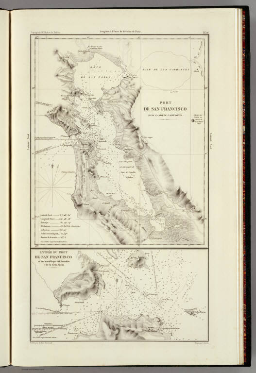
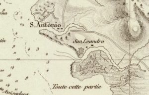
This map showing Alameda, California in 1844 is one of the earliest of Alameda that I could find. The image to the left is a close-up from that map made in 1844 – five years before the gold rush. It is almost hard to even recognize Alameda in the map, because, for one thing, Alameda was not an Island then. The canal that connects the San Antonio Creek with the San Leandro Bay had not been dredged. Alameda is the area on the map roughly between the labels “S. Antonio” (San Antonio Creek) and the label “San Leandro” (San Leandro Bay). Bay Farm is seen here below the “San Leandro” label, and is virtually all marsh, except for a tiny land area (white area here on map).
I think one reason there is not much of a distinction between “San Leandro Bay” and the San Leandro Creek on this map, is because at this time they probably were more one unit, but quickly changed — as upstream logging in the Oakland Hills, which began in earnest around 1844, had major physical impacts on this area.
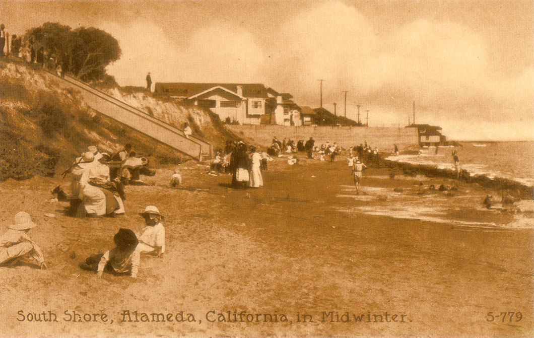
Also somewhat surprising, due to the difference from today, is the strong indication of a very sharp Alameda shoreline along the San Francisco Bay, very steep, almost appears as a cliff in the map’s rendition. The postcard at the right, circa 1909, of South Shore, seems to support this — as it very clearly shows a very large and steep drop from the Alameda mainland down to the San Francisco Bay’s shore, at least in the area seen in the postcard. Naturally this would have been well before the South Shore landfill, which occurred at a much later time.
Lake Merritt hasn’t been “made” yet . It was made in 1869.
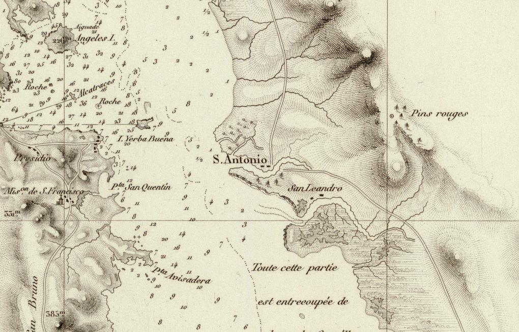
The picture to the right is from the same map, but shows a larger area.
Notice the “Pins Rouge” (redwood trees) in the Oakland Hills. It is also very interesting to note that the only other place on the map that is indicating redwood trees is in Alameda, indicating it is likely that at this time there were a substantial number of redwood trees in Alameda.
Very early in the San Francisco Bay Area’s urbanization history, and in a span of just ten years, by 1855 virtually all of the old growth Redwood Trees in the Oakland Hills, which are believed to have been some of the oldest and largest in the world, were virtually completely cut down, leaving only their stumps (even these would later be harvested). The lumber from the trees, milled at saws locally in the Oakland Hills, was sold to builders of early San Francisco.